Real-time alerts and community engagement for effective flood control.
Overview
The government's flood management system is a comprehensive database that could forecast water-related difficulties and help authorities plan for them. The goal was to create a platform that would improve the state's water resource management, benefiting residents who use it every day. The app connects people in the community by letting them report problems and get information about them.
Domain
Government Flood Management
Platform
Web & Mobile App
Year
2022-23
The Challenge
- To gather and combine information regarding the state's regular recorded rainfall, water levels, and water discharge into a single platform for the purpose of analysing, making decisions and have a record for lifetime.
- To facilitate timely planning and action through personalised and instant alerts to different stakeholders
- To establish a connection with the community in order to enhance flood management in specific regions and provide them with the ability to report incidents via the app.
Solution
Making a difference in flood management by reporting incidents, sending alerts, and providing critical water-related data.
Key features
Discover some features of this product.
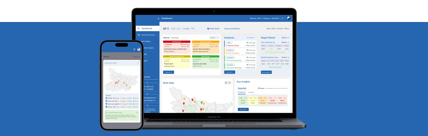
Information Product Management
Integration, analysis, and lifelong record-keeping of real-time data on rainfall, water level, and water discharge from rivers, basins, sub-basins, barrages, and stations in various geographical areas.
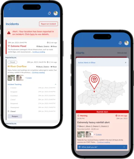
Alert Management
Exclusive alert system that allows admins to create alerts based on water level, rainfall, water discharge, and general information, with defined severity and targets.
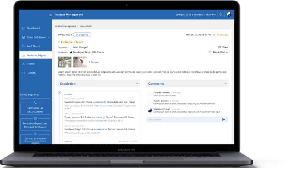
Incident Management
A system that is built for transparency and inclusivity, enabling stakeholders to track the status of incidents and assign them to relevant officials. If the solution doesn't meet expectations, reporters can reopen the incident for a satisfactory resolution.
Real-time map interaction/location
Real-time map interaction, displaying alerts and incidents at a highly granular level and managing the current location based on the stakeholder's designation and jurisdiction